Geolocate

Matungao topographic map

Click on the map to display elevation.

About this map

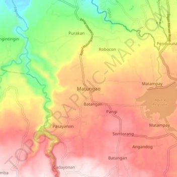
Name: Matungao topographic map, elevation, terrain.

Location: Matungao, Lanao del Norte, Northern Mindanao, Philippines (8.09322 124.12713 8.17322 124.20713)

Average elevation: 1,017 ft

Minimum elevation: 39 ft

Maximum elevation: 1,739 ft

Other topographic maps

Click on a map to view its topography, its elevation and its terrain.

Linamon

Philippines > Lanao del Norte

Average elevation: 138 ft

Kolambugan

Philippines > Lanao del Norte

Average elevation: 180 ft

Gear up for your next adventure:

🛠️Outdoor Gear Repair Kit - Essential tools to fix gear on the trail
🧴Hand Sanitizer - Keep hands clean while hiking
🚪Portable Camp Chair - Foldable chair for comfort at camp
🔪Outdoor Multitools - Essential survival tools for gear repair and field use
🧭Hiking Compass - Precision compass for reliable navigation in the wilderness

As an Amazon Associate, this site earns from qualifying purchases at no extra cost to you.