
Thank you for supporting this site ❤️
Make a donation
Make a donation
Gear up for your next adventure:
As an Amazon Associate, this site earns from qualifying purchases at no extra cost to you.
Percuil topographic map
Click on the map to display elevation.
Thank you for supporting this site ❤️
Make a donation
Make a donation
Gear up for your next adventure:
As an Amazon Associate, this site earns from qualifying purchases at no extra cost to you.
About this map
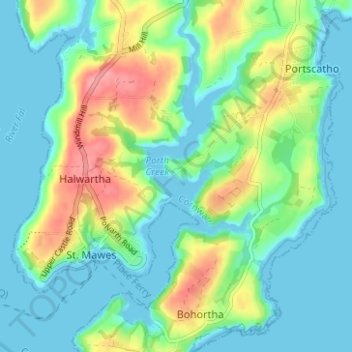
Name: Percuil topographic map, elevation, terrain.
Location: Percuil, Gerrans, Cornwall, England, TR2 5AS, United Kingdom (50.14751 -5.01975 50.18751 -4.97975)
Average elevation: 79 ft
Minimum elevation: -7 ft
Maximum elevation: 269 ft
Thank you for supporting this site ❤️
Make a donation
Make a donation
Gear up for your next adventure:
As an Amazon Associate, this site earns from qualifying purchases at no extra cost to you.