
Thank you for supporting this site ❤️
Make a donation
Make a donation
Gear up for your next adventure:
As an Amazon Associate, this site earns from qualifying purchases at no extra cost to you.
Sumera topographic map
Click on the map to display elevation.
Thank you for supporting this site ❤️
Make a donation
Make a donation
Gear up for your next adventure:
As an Amazon Associate, this site earns from qualifying purchases at no extra cost to you.
About this map
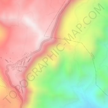
Name: Sumera topographic map, elevation, terrain.
Location: Sumera, Quinchía, Vertiente Occidental, Risaralda, Colombia (5.31046 -75.78845 5.33046 -75.76845)
Average elevation: 6,316 ft
Minimum elevation: 4,892 ft
Maximum elevation: 7,267 ft
Thank you for supporting this site ❤️
Make a donation
Make a donation
Gear up for your next adventure:
As an Amazon Associate, this site earns from qualifying purchases at no extra cost to you.