
Preston topographic map
Click on the map to display elevation.
About this map
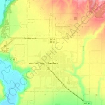
Name: Preston topographic map, elevation, terrain.
Location: Preston, Franklin County, Idaho, United States (42.07170 -111.91842 42.13339 -111.84723)
Average elevation: 4,705 ft
Minimum elevation: 4,446 ft
Maximum elevation: 4,967 ft
Franklin County trails, hiking, mountain biking, running and outdoor activities
Other topographic maps
Click on a map to view its topography, its elevation and its terrain.