
Lincoln topographic map
Interactive map
Click on the map to display elevation.
About this map
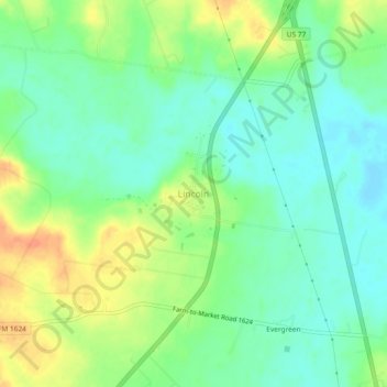
Name: Lincoln topographic map, elevation, terrain.
Location: Lincoln, Lee County, Texas, 78948, United States (30.26374 -96.98410 30.30374 -96.94410)
Average elevation: 384 ft
Minimum elevation: 331 ft
Maximum elevation: 463 ft
Lincoln is an unincorporated community in central Lee County, Texas, United States. It lies along Highway 21 north of the city of Giddings, the county seat of Lee County. Its elevation is 371 feet (113 m). Although Lincoln is unincorporated, it has a post office, with the ZIP code of 78948.
Other topographic maps
Click on a map to view its topography, its elevation and its terrain.
Dime Box
United States > Texas > Lee County > Dime Box
Dime Box, Lee County, Texas, 77853, United States
Average elevation: 364 ft
Giddings
United States > Texas > Lee County
Giddings, Lee County, Texas, 78942, United States
Average elevation: 463 ft