Geolocate

Erm topographic map

Click on the map to display elevation.

About this map
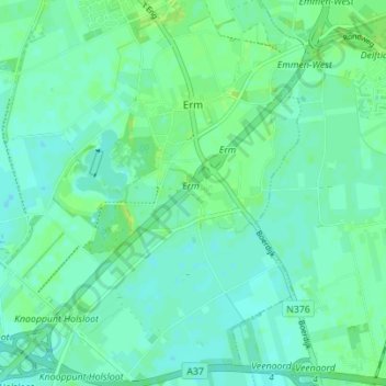
Name: Erm topographic map, elevation, terrain.

Location: Erm, Coevorden, Drenthe, Nederland (52.72540 6.77040 52.76570 6.83969)

Average elevation: 49 ft

Minimum elevation: 33 ft

Maximum elevation: 75 ft

Other topographic maps

Click on a map to view its topography, its elevation and its terrain.

Steenwijksmoer

Nederland > Drenthe > Coevorden

Average elevation: 36 ft

De Bente

Nederland > Drenthe > Coevorden > Dalen

Average elevation: 39 ft

Vlieghuis

Nederland > Drenthe > Coevorden

Average elevation: 39 ft

Veenhuizen

Nederland > Drenthe > Coevorden > Dalen

Average elevation: 39 ft

Den Hool

Nederland > Drenthe > Coevorden

Average elevation: 43 ft

Vossebelt

Nederland > Drenthe > Coevorden > Dalen

Average elevation: 36 ft

Achterste-Erm

Nederland > Drenthe > Coevorden > Erm

Average elevation: 49 ft

Kibbelveen

Nederland > Drenthe > Coevorden > Schoonoord

Average elevation: 62 ft

Weijerswold

Nederland > Drenthe > Coevorden

Average elevation: 36 ft

Gear up for your next adventure:

🧼Biodegradable Camping Soap - Eco‑friendly soap for outdoor hygiene
🔋Rechargeable Batteries - Power up your outdoor devices
🧣Hiking Neck Gaiter - Multi‑use neck protection for outdoor weather
🪵Folding Camp Saw - Compact saw for wood and campsite work
🥩Freeze-Dried Meals - Nutritious and lightweight food for remote expeditions

As an Amazon Associate, this site earns from qualifying purchases at no extra cost to you.