Geolocate

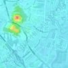
Juru topographic map

Click on the map to display elevation.

About this map

Name: Juru topographic map, elevation, terrain.

Location: Juru, Bukit Mertajam, Central Seberang Perai District, Seberang Perai, Penang, Malaysia (5.32841 100.41559 5.36567 100.45273)

Average elevation: 20 ft

Minimum elevation: -3 ft

Maximum elevation: 194 ft

Other topographic maps

Click on a map to view its topography, its elevation and its terrain.

Kampung Telok Wang

Malaysia > Penang > Bukit Mertajam

Average elevation: 79 ft

Kampung Cross Street

Malaysia > Penang > Bukit Mertajam

Average elevation: 92 ft

Ladang Chip Joo

Malaysia > Penang > Bukit Mertajam

Average elevation: 23 ft

Kampung Baru

Malaysia > Penang > Bukit Mertajam

Average elevation: 46 ft

Kampung Sungai Rambai

Malaysia > Penang > Bukit Mertajam

Average elevation: 43 ft

Gear up for your next adventure:

🚗GPS Dash Cams - Record your scenic drives through mountain passes and canyons
❄️Traction Cleats - Prevent slips on icy trails during winter hikes
🔦Powerful Headlamps - Ultra-bright hands-free lighting for night navigation
🪑Portable Camp Table - Compact table for campsite meals
🧭Orienteering Set - Complete compass and map reading kit

As an Amazon Associate, this site earns from qualifying purchases at no extra cost to you.