Geolocate

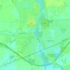
Amberg topographic map

Click on the map to display elevation.

About this map

Name: Amberg topographic map, elevation, terrain.

Location: Amberg, Town of Amberg, Marinette County, Wisconsin, 54102, United States (45.48302 -88.01373 45.52302 -87.97373)

Average elevation: 909 ft

Minimum elevation: 817 ft

Maximum elevation: 981 ft

Marinette County trails, hiking, mountain biking, running and outdoor activities

Other topographic maps

Click on a map to view its topography, its elevation and its terrain.
Stovekin Lake

United States > Wisconsin > Marinette County

Average elevation: 1,001 ft

Peshtigo

United States > Wisconsin > Marinette County

Average elevation: 610 ft

Town of Niagra

United States > Wisconsin > Marinette County

Average elevation: 1,014 ft

Niagara

United States > Wisconsin > Marinette County

Average elevation: 1,020 ft

Gear up for your next adventure:

🧢Sun Protection Hats - Wide-brimmed and UPF-rated hats for high-altitude sun safety
🧤Tactile Hiking Gloves - Keep hands warm while operating GPS and smartphone screens
🪓Survival Multi‑Tool - Versatile tool for camp and trail tasks
⛺Backpacking Tents - Weight-optimized shelters for multi-day topographic surveys
🧤Hiking Gloves - Protective gloves for rugged trails

As an Amazon Associate, this site earns from qualifying purchases at no extra cost to you.