
Thank you for supporting this site ❤️
Make a donation
Make a donation
Gear up for your next adventure:
As an Amazon Associate, this site earns from qualifying purchases at no extra cost to you.
Puiggròs topographic map
Click on the map to display elevation.
Thank you for supporting this site ❤️
Make a donation
Make a donation
Gear up for your next adventure:
As an Amazon Associate, this site earns from qualifying purchases at no extra cost to you.
About this map
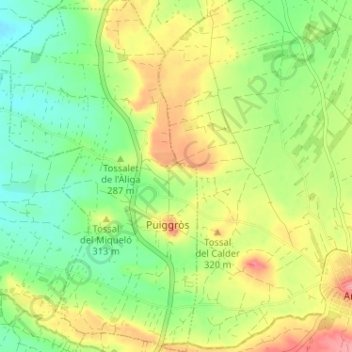
Name: Puiggròs topographic map, elevation, terrain.
Location: Puiggròs, Garrigues, Lleida, Catalonia, 25420, Spain (41.53365 0.85136 41.58165 0.89451)
Average elevation: 945 ft
Minimum elevation: 801 ft
Maximum elevation: 1,138 ft
Thank you for supporting this site ❤️
Make a donation
Make a donation
Gear up for your next adventure:
As an Amazon Associate, this site earns from qualifying purchases at no extra cost to you.