
Thank you for supporting this site ❤️
Make a donation
Make a donation
Gear up for your next adventure:
As an Amazon Associate, this site earns from qualifying purchases at no extra cost to you.
Padiyathalawa topographic map
Click on the map to display elevation.
Thank you for supporting this site ❤️
Make a donation
Make a donation
Gear up for your next adventure:
As an Amazon Associate, this site earns from qualifying purchases at no extra cost to you.
About this map
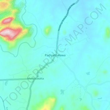
Name: Padiyathalawa topographic map, elevation, terrain.
Location: Padiyathalawa, Ampara District, Eastern Province, Sri Lanka (7.36020 81.20246 7.44020 81.28246)
Average elevation: 499 ft
Minimum elevation: 262 ft
Maximum elevation: 2,234 ft
Thank you for supporting this site ❤️
Make a donation
Make a donation
Gear up for your next adventure:
As an Amazon Associate, this site earns from qualifying purchases at no extra cost to you.