Geolocate

Val Sangone topographic map

Click on the map to display elevation.

About this map

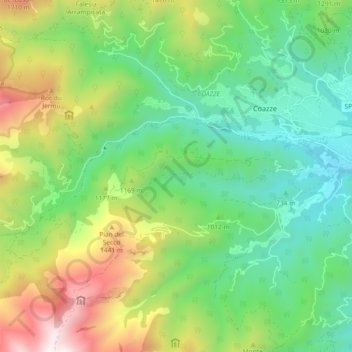
Name: Val Sangone topographic map, elevation, terrain.

Location: Val Sangone, Coazze, Torino, Piemonte, Italia (45.02882 7.23225 45.05041 7.32414)

Average elevation: 3,458 ft

Minimum elevation: 1,857 ft

Maximum elevation: 6,555 ft

Other topographic maps

Click on a map to view its topography, its elevation and its terrain.

Forno di Coazze

Italia > Piemonte > Torino > Coazze

Average elevation: 4,091 ft

Dirotto-Sangonetto

Italia > Piemonte > Torino > Coazze

Average elevation: 3,025 ft

Marini

Italia > Piemonte > Torino > Coazze

Average elevation: 3,127 ft

Clotti

Italia > Piemonte > Torino > Coazze

Average elevation: 3,274 ft

Forno di Coazze

Italia > Piemonte > Torino > Coazze

Average elevation: 4,091 ft

Gear up for your next adventure:

🥾Hiking Shoes - Durable and comfortable shoes for trail hiking
🌎3D Topographic Globes - Raised relief globes for a tactile understanding of geography
🏥Hiking First Aid Kits - Comprehensive medical kits for remote trail injuries
🩹Survival Bandages - High‑quality bandages for emergencies
🏔️Mountain Trail Maps - High‑detail maps for popular peaks

As an Amazon Associate, this site earns from qualifying purchases at no extra cost to you.