
Thank you for supporting this site ❤️
Make a donation
Make a donation
Gear up for your next adventure:
As an Amazon Associate, this site earns from qualifying purchases at no extra cost to you.
Rzeszów topographic map
Click on the map to display elevation.
Thank you for supporting this site ❤️
Make a donation
Make a donation
Gear up for your next adventure:
As an Amazon Associate, this site earns from qualifying purchases at no extra cost to you.
About this map
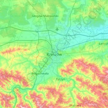
Name: Rzeszów topographic map, elevation, terrain.
Location: Rzeszów, Subcarpathian Voivodeship, 35-061, Poland (49.87745 21.84472 50.19745 22.16472)
Average elevation: 833 ft
Minimum elevation: 604 ft
Maximum elevation: 1,450 ft
Thank you for supporting this site ❤️
Make a donation
Make a donation
Gear up for your next adventure:
As an Amazon Associate, this site earns from qualifying purchases at no extra cost to you.