Geolocate

Liddington topographic map

Click on the map to display elevation.

About this map

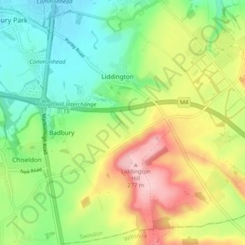
Name: Liddington topographic map, elevation, terrain.

Location: Liddington, Swindon, England, United Kingdom (51.50317 -1.73203 51.54336 -1.65904)

Average elevation: 564 ft

Minimum elevation: 338 ft

Maximum elevation: 909 ft

Gear up for your next adventure:

🧤Tactile Hiking Gloves - Keep hands warm while operating GPS and smartphone screens
🛰️Handheld GPS Units - Professional satellite navigators for precise backcountry mapping
🛶Inflatable Kayak - Portable kayak for rivers, lakes, and expeditions
🧭GPS Watch Accessories - Bands and chargers for GPS watches
📡Handheld GPS Device - Reliable handheld GPS for outdoor navigation

As an Amazon Associate, this site earns from qualifying purchases at no extra cost to you.