Geolocate

Valdosta topographic map

Click on the map to display elevation.

About this map

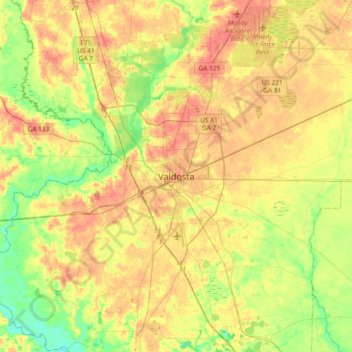
Name: Valdosta topographic map, elevation, terrain.

Location: Valdosta, Lowndes County, Georgia, 31604, United States (30.67270 -83.43849 30.99270 -83.11849)

Average elevation: 177 ft

Minimum elevation: 79 ft

Maximum elevation: 272 ft

Lowndes County trails, hiking, mountain biking, running and outdoor activities

Gear up for your next adventure:

🔦Powerful Headlamps - Ultra-bright hands-free lighting for night navigation
🪶Multi‑Purpose Knife - Useful blade for camp and trail
🌎3D Topographic Globes - Raised relief globes for a tactile understanding of geography
🧭Pro Hiking Compasses - High-accuracy liquid-filled compasses for topographic orientation
🥄Camping Utensil Set - Lightweight utensils for outdoor meals

As an Amazon Associate, this site earns from qualifying purchases at no extra cost to you.