
Bristol topographic map
Click on the map to display elevation.
About this map
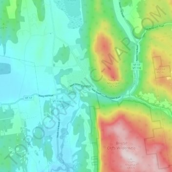
Name: Bristol topographic map, elevation, terrain.
Location: Bristol, Addison County, Vermont, United States (44.09327 -73.11852 44.17327 -73.03852)
Average elevation: 876 ft
Minimum elevation: 312 ft
Maximum elevation: 2,293 ft
Addison County trails, hiking, mountain biking, running and outdoor activities