
Magdeburg topographic map
Click on the map to display elevation.
About this map
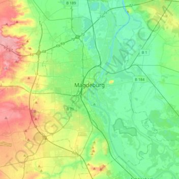
Name: Magdeburg topographic map, elevation, terrain.
Location: Magdeburg, Saxony-Anhalt, Germany (52.02375 11.51724 52.22836 11.76399)
Average elevation: 217 ft
Minimum elevation: 102 ft
Maximum elevation: 472 ft
Other topographic maps
Click on a map to view its topography, its elevation and its terrain.
Brocken
Germany > Saxony-Anhalt > Landkreis Harz > Wernigerode
The Brocken, also sometimes referred to as the Blocksberg, is the highest peak in the Harz mountain range and also the highest peak in Northern Germany; it is near Schierke in the German state of Saxony-Anhalt between the rivers Weser and Elbe. Although its elevation of 1,141 metres (3,743 ft) is below alpine…
Average elevation: 3,159 ft
Lutherstadt Wittenberg
Germany > Saxony-Anhalt > Wittenberg > Wittenberg > Lutherstadt Wittenberg
Average elevation: 259 ft