
Tamworth topographic map
Click on the map to display elevation.
About this map
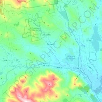
Name: Tamworth topographic map, elevation, terrain.
Location: Tamworth, Carroll County, New Hampshire, United States (43.77490 -71.35984 43.92464 -71.18935)
Average elevation: 863 ft
Minimum elevation: 397 ft
Maximum elevation: 2,677 ft
Other topographic maps
Click on a map to view its topography, its elevation and its terrain.