Geolocate

Castillejos topographic map

Click on the map to display elevation.

About this map

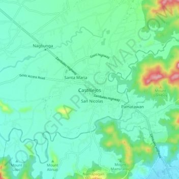
Name: Castillejos topographic map, elevation, terrain.

Location: Castillejos, Zambales, Central Luzon, 2208, Philippines (14.89030 120.16504 14.97030 120.24504)

Average elevation: 207 ft

Minimum elevation: 10 ft

Maximum elevation: 1,014 ft

Gear up for your next adventure:

🎒Hydration Pack - Hands‑free water reservoir for long hikes
🛌Ultralight Sleeping Bags - Compact down bags for cold nights in the wilderness
🕶️Glacier Sunglasses - Side shields to protect eyes from high-altitude snow glare
📡Handheld GPS Device - Reliable handheld GPS for outdoor navigation
🌧️Backpack Rain Cover - Keep gear dry in wet weather

As an Amazon Associate, this site earns from qualifying purchases at no extra cost to you.