Geolocate

Soci topographic map

Click on the map to display elevation.

About this map

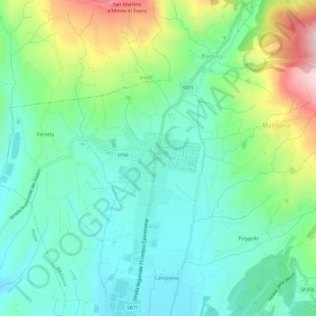
Name: Soci topographic map, elevation, terrain.

Location: Soci, Bibbiena, Arezzo, Tuscany, 52014, Italy (43.71720 11.79335 43.75720 11.83335)

Average elevation: 1,493 ft

Minimum elevation: 1,145 ft

Maximum elevation: 2,352 ft

Gear up for your next adventure:

🧥Waterproof Jacket for Hiking - Breathable and rugged rain jacket for outdoor excursions
💧Water Filtration Bottles - Safely drink from streams and lakes while exploring
🌡️Portable Weather Meter - Track weather conditions on the trail
🥾Hiking Shoes - Durable and comfortable shoes for trail hiking
🔋Solar Power Banks - Keep your GPS and phone charged in remote wilderness areas

As an Amazon Associate, this site earns from qualifying purchases at no extra cost to you.