
Thank you for supporting this site ❤️
Make a donation
Make a donation
Gear up for your next adventure:
As an Amazon Associate, this site earns from qualifying purchases at no extra cost to you.
Rihana topographic map
Click on the map to display elevation.
Thank you for supporting this site ❤️
Make a donation
Make a donation
Gear up for your next adventure:
As an Amazon Associate, this site earns from qualifying purchases at no extra cost to you.
About this map
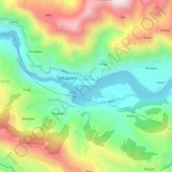
Name: Rihana topographic map, elevation, terrain.
Location: Rihana, Jeora, Karsog, Mandi, Himachal Pradesh, 175009, India (31.22674 77.07312 31.26674 77.11312)
Average elevation: 3,097 ft
Minimum elevation: 1,995 ft
Maximum elevation: 4,797 ft
Thank you for supporting this site ❤️
Make a donation
Make a donation
Gear up for your next adventure:
As an Amazon Associate, this site earns from qualifying purchases at no extra cost to you.