Geolocate

Townsend topographic map

Click on the map to display elevation.

About this map

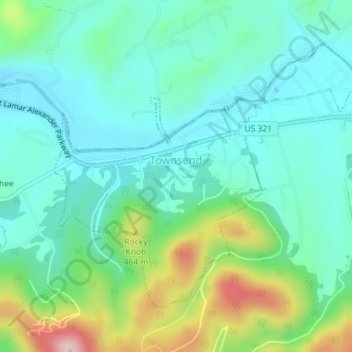
Name: Townsend topographic map, elevation, terrain.

Location: Townsend, Blount County, Tennessee, United States (35.66323 -83.76812 35.68483 -83.73249)

Average elevation: 1,234 ft

Minimum elevation: 1,001 ft

Maximum elevation: 1,909 ft

Just to the north and west of Townsend, the Foothills Parkway is a national parkway that traverses Chilhowee Mountain and offers multiple scenic overlooks at high elevations, with views of the Smokies to the south and the Tennessee Valley and Cumberland Plateau to the north and west. As of 2016, road construction on the parkway to complete the "missing link" from Walland to Wears Valley can be seen from Townsend during the mid-day and afternoon. This section eventually opened in late 2018, more than half a century after the first section opened in 1966.

(CC-BY-SA 3.0)

Other topographic maps

Click on a map to view its topography, its elevation and its terrain.

Maryville

United States > Tennessee > Blount County

Maryville, Blount County, East Tennessee, Tennessee, 37802, United States

Average elevation: 978 ft

Great Smoky Mountains National Park

United States > Tennessee > Blount County

Great Smoky Mountains National Park, Blount County, Tennessee, 37878, United States

Average elevation: 2,510 ft

Cades Cove

United States > Tennessee > Blount County

Cades Cove, Blount County, Tennessee, United States

Average elevation: 2,152 ft

Walland

United States > Tennessee > Blount County

Walland, Blount County, Tennessee, 37886, United States

Average elevation: 1,266 ft

Rockford

United States > Tennessee > Blount County

Rockford, Blount County, Tennessee, United States

Average elevation: 912 ft

Friendsville

United States > Tennessee > Blount County

Friendsville, Blount County, Tennessee, United States

Average elevation: 919 ft

Louisville

United States > Tennessee > Blount County

Louisville, Blount County, East Tennessee, Tennessee, 37777, United States

Average elevation: 899 ft

Alcoa

United States > Tennessee > Blount County

Alcoa, Blount County, Tennessee, United States

Average elevation: 909 ft

Calderwood Lake

United States > Tennessee > Blount County

Calderwood Lake, Blount County, Tennessee, United States

Average elevation: 1,657 ft

Iris Acres

United States > Tennessee > Blount County > Alcoa > Alcoa

Iris Acres, Alcoa, Blount County, Tennessee, 37701, United States

Average elevation: 883 ft

Tremont

United States > Tennessee > Blount County

Tremont, Blount County, Tennessee, United States

Average elevation: 1,906 ft

Prospect

United States > Tennessee > Blount County

Prospect, Blount County, Tennessee, United States

Average elevation: 997 ft

Bent Tree

United States > Tennessee > Blount County

Bent Tree, Blount County, Tennessee, 37701, United States

Average elevation: 906 ft

Rowans Creek

United States > Tennessee > Blount County

Rowans Creek, Blount County, Tennessee, United States

Average elevation: 3,747 ft