Geolocate

Fort Valley topographic map

Click on the map to display elevation.

About this map

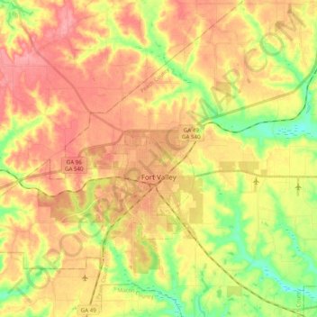
Name: Fort Valley topographic map, elevation, terrain.

Location: Fort Valley, Peach County, Georgia, 31030, United States (32.52122 -83.91600 32.60566 -83.71996)

Average elevation: 482 ft

Minimum elevation: 318 ft

Maximum elevation: 614 ft

Peach County trails, hiking, mountain biking, running and outdoor activities

Other topographic maps

Click on a map to view its topography, its elevation and its terrain.

Miami Valley

United States > Georgia > Peach County > Fort Valley

Average elevation: 443 ft

Miami Valley

United States > Georgia > Peach County > Fort Valley

Average elevation: 443 ft

Alpine Heights

United States > Georgia > Peach County > Byron

Average elevation: 482 ft

Grogan

United States > Georgia > Peach County

Average elevation: 548 ft

Gear up for your next adventure:

🪄Magnetic Compass - Accurate compass for navigation
📡Handheld GPS Device - Reliable handheld GPS for outdoor navigation
🕶️GPS Smartphone Mount - Secure mount for phone navigation
🗃️Trail First Aid Kit - Essential kit for outdoor injuries and emergencies
📻Weather Alert Radios - Stay informed of storm risks while off-the-grid

As an Amazon Associate, this site earns from qualifying purchases at no extra cost to you.