Geolocate

Fairfield topographic map

Click on the map to display elevation.

About this map

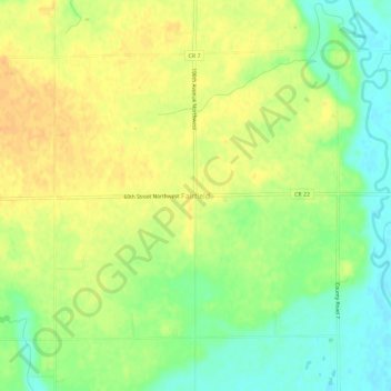
Name: Fairfield topographic map, elevation, terrain.

Location: Fairfield, Swift County, Minnesota, United States (45.36385 -95.99366 45.40385 -95.95366)

Average elevation: 1,093 ft

Minimum elevation: 1,033 ft

Maximum elevation: 1,135 ft

Swift County trails, hiking, mountain biking, running and outdoor activities

Gear up for your next adventure:

📚Navigation Handbooks - Master the art of reading topographic maps and using a compass
📚USA Hiking Guide Books - Top trail guides and map books
🔭Compact Binoculars - HD vision for scouting terrain and identifying distant landmarks
🧣Hiking Neck Gaiter - Multi‑use neck protection for outdoor weather
🧷Carabiner Set - Durable clips for gear attachment

As an Amazon Associate, this site earns from qualifying purchases at no extra cost to you.