
Ouled Sabor topographic map
Interactive map
Click on the map to display elevation.
About this map
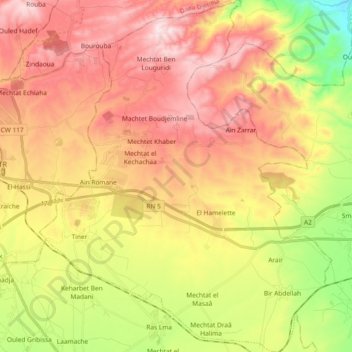
Name: Ouled Sabor topographic map, elevation, terrain.
Location: Ouled Sabor, Daïra Guidjel, Sétif, Algérie (36.10695 5.46810 36.25671 5.62258)
Average elevation: 3,510 ft
Minimum elevation: 2,592 ft
Maximum elevation: 4,318 ft
Other topographic maps
Click on a map to view its topography, its elevation and its terrain.
Mechtet Khaber
Algérie > Sétif > Daïra Guidjel > Ouled Sabor > Mechtet Khaber
Mechtet Khaber, Ouled Sabor, Daïra Guidjel, Sétif, 19120, Algérie
Average elevation: 3,783 ft