Geolocate

Topsy topographic map

Click on the map to display elevation.

About this map

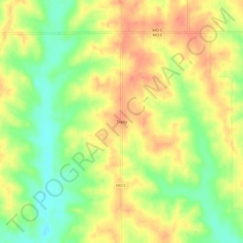
Name: Topsy topographic map, elevation, terrain.

Location: Topsy, Mercer County, Missouri, United States (40.33307 -93.49994 40.37307 -93.45994)

Average elevation: 997 ft

Minimum elevation: 906 ft

Maximum elevation: 1,066 ft

Mercer County trails, hiking, mountain biking, running and outdoor activities

Gear up for your next adventure:

🩳Quick‑Dry Hiking Shorts - Comfortable and quick‑dry shorts for summer hiking
🧢Sun Protection Hats - Wide-brimmed and UPF-rated hats for high-altitude sun safety
🧯Portable Fire Pit - Compact fire pit for camping spots
🪵Folding Camp Saw - Compact saw for wood and campsite work
🪶Multi‑Purpose Knife - Useful blade for camp and trail

As an Amazon Associate, this site earns from qualifying purchases at no extra cost to you.