
Thank you for supporting this site ❤️
Make a donation
Make a donation
Gear up for your next adventure:
As an Amazon Associate, this site earns from qualifying purchases at no extra cost to you.
Herbert topographic map
Click on the map to display elevation.
Thank you for supporting this site ❤️
Make a donation
Make a donation
Gear up for your next adventure:
As an Amazon Associate, this site earns from qualifying purchases at no extra cost to you.
About this map
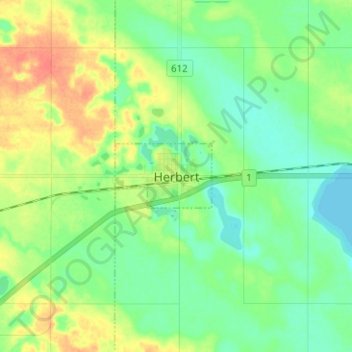
Name: Herbert topographic map, elevation, terrain.
Location: Herbert, Saskatchewan, S0H 2A0, Kanada (50.38632 -107.26019 50.46632 -107.18019)
Average elevation: 2,313 ft
Minimum elevation: 2,264 ft
Maximum elevation: 2,392 ft
Thank you for supporting this site ❤️
Make a donation
Make a donation
Gear up for your next adventure:
As an Amazon Associate, this site earns from qualifying purchases at no extra cost to you.