
Thank you for supporting this site ❤️
Make a donation
Make a donation
Gear up for your next adventure:
As an Amazon Associate, this site earns from qualifying purchases at no extra cost to you.
Tubay topographic map
Click on the map to display elevation.
Thank you for supporting this site ❤️
Make a donation
Make a donation
Gear up for your next adventure:
As an Amazon Associate, this site earns from qualifying purchases at no extra cost to you.
About this map
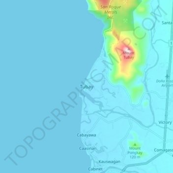
Name: Tubay topographic map, elevation, terrain.
Location: Tubay, Agusan del Norte, Caraga, 6805, Philippines (9.12507 125.48269 9.20507 125.56269)
Average elevation: 82 ft
Minimum elevation: -7 ft
Maximum elevation: 1,421 ft
Thank you for supporting this site ❤️
Make a donation
Make a donation
Gear up for your next adventure:
As an Amazon Associate, this site earns from qualifying purchases at no extra cost to you.