Geolocate

Hunza River topographic map

Click on the map to display elevation.

About this map

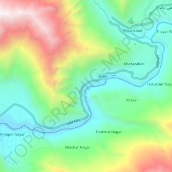
Name: Hunza River topographic map, elevation, terrain.

Location: Hunza River, Minapin Nagar, Gilgit-Baltistan, Pakistan (36.25299 74.52548 36.29217 74.61532)

Average elevation: 8,855 ft

Minimum elevation: 6,302 ft

Maximum elevation: 14,377 ft

Gear up for your next adventure:

🎁Geography Themed Gifts - Unique gift ideas for map lovers and geography enthusiasts
🛰️Handheld GPS Units - Professional satellite navigators for precise backcountry mapping
💧Water Purification System - Clean water on the trail with reliable purifiers
🧭Compass with Lanyard - Easy‑carry compass for navigation
👓Polarized Sunglasses - Outdoor sunglasses for glare reduction

As an Amazon Associate, this site earns from qualifying purchases at no extra cost to you.