
Thank you for supporting this site ❤️
Make a donation
Make a donation
Gear up for your next adventure:
As an Amazon Associate, this site earns from qualifying purchases at no extra cost to you.
Zarema topographic map
Click on the map to display elevation.
Thank you for supporting this site ❤️
Make a donation
Make a donation
Gear up for your next adventure:
As an Amazon Associate, this site earns from qualifying purchases at no extra cost to you.
About this map
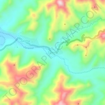
Name: Zarema topographic map, elevation, terrain.
Location: Zarema, North Gondar, Amhara Region, Ethiopia (13.31637 37.87322 13.35637 37.91322)
Average elevation: 4,514 ft
Minimum elevation: 3,944 ft
Maximum elevation: 5,495 ft
Thank you for supporting this site ❤️
Make a donation
Make a donation
Gear up for your next adventure:
As an Amazon Associate, this site earns from qualifying purchases at no extra cost to you.