
Thank you for supporting this site ❤️
Make a donation
Make a donation
Gear up for your next adventure:
As an Amazon Associate, this site earns from qualifying purchases at no extra cost to you.
Jumilla topographic map
Click on the map to display elevation.
Thank you for supporting this site ❤️
Make a donation
Make a donation
Gear up for your next adventure:
As an Amazon Associate, this site earns from qualifying purchases at no extra cost to you.
About this map
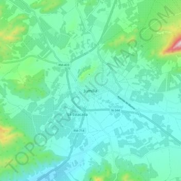
Name: Jumilla topographic map, elevation, terrain.
Location: Jumilla, Altiplano, Region of Murcia, 30520, Spain (38.43347 -1.36854 38.51347 -1.28854)
Average elevation: 1,818 ft
Minimum elevation: 1,447 ft
Maximum elevation: 3,481 ft
Thank you for supporting this site ❤️
Make a donation
Make a donation
Gear up for your next adventure:
As an Amazon Associate, this site earns from qualifying purchases at no extra cost to you.