
Make a donation
Gear up for your next adventure:
As an Amazon Associate, this site earns from qualifying purchases at no extra cost to you.
Latta topographic map
Click on the map to display elevation.
Make a donation
Gear up for your next adventure:
As an Amazon Associate, this site earns from qualifying purchases at no extra cost to you.
About this map
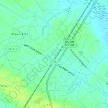
Name: Latta topographic map, elevation, terrain.
Location: Latta, Dillon County, South Carolina, United States (34.33005 -79.44695 34.34916 -79.42161)
Average elevation: 108 ft
Minimum elevation: 89 ft
Maximum elevation: 141 ft
Dillon County trails, hiking, mountain biking, running and outdoor activities
Make a donation
Gear up for your next adventure:
As an Amazon Associate, this site earns from qualifying purchases at no extra cost to you.
Other topographic maps
Click on a map to view its topography, its elevation and its terrain.
Hamer
United States > South Carolina > Dillon County
Its elevation is 144 feet (44 m).
Average elevation: 138 ft