Geolocate

Cofer topographic map

Click on the map to display elevation.

About this map

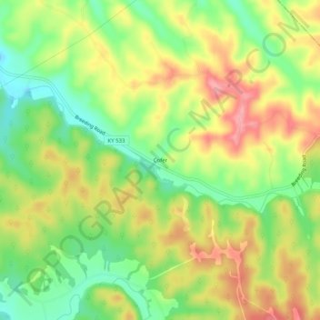
Name: Cofer topographic map, elevation, terrain.

Location: Cofer, Metcalfe County, Kentucky, United States (36.93978 -85.51024 36.97978 -85.47024)

Average elevation: 896 ft

Minimum elevation: 722 ft

Maximum elevation: 1,076 ft

Metcalfe County trails, hiking, mountain biking, running and outdoor activities

Gear up for your next adventure:

🛡️Insect Repellent - Protection against bugs during outdoor activities
🧭Pro Hiking Compasses - High-accuracy liquid-filled compasses for topographic orientation
🚑Emergency Bivvies - Heat-reflective sleeping bags for survival situations
📚USA Hiking Guide Books - Top trail guides and map books
Backpacking Tent - Lightweight and durable tent for multi‑day hikes

As an Amazon Associate, this site earns from qualifying purchases at no extra cost to you.