
Thank you for supporting this site ❤️
Make a donation
Make a donation
Gear up for your next adventure:
As an Amazon Associate, this site earns from qualifying purchases at no extra cost to you.
Tseminyu topographic map
Click on the map to display elevation.
Thank you for supporting this site ❤️
Make a donation
Make a donation
Gear up for your next adventure:
As an Amazon Associate, this site earns from qualifying purchases at no extra cost to you.
About this map
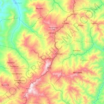
Name: Tseminyu topographic map, elevation, terrain.
Location: Tseminyu, Kohima, Nagaland, 797109, India (25.86060 94.07651 25.99200 94.29767)
Average elevation: 3,166 ft
Minimum elevation: 919 ft
Maximum elevation: 5,656 ft
Thank you for supporting this site ❤️
Make a donation
Make a donation
Gear up for your next adventure:
As an Amazon Associate, this site earns from qualifying purchases at no extra cost to you.