
Thank you for supporting this site ❤️
Make a donation
Make a donation
Gear up for your next adventure:
As an Amazon Associate, this site earns from qualifying purchases at no extra cost to you.
Solagna topographic map
Click on the map to display elevation.
Thank you for supporting this site ❤️
Make a donation
Make a donation
Gear up for your next adventure:
As an Amazon Associate, this site earns from qualifying purchases at no extra cost to you.
About this map
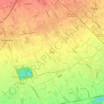
Name: Solagna topographic map, elevation, terrain.
Location: Solagna, Falzè, Trevignano, Treviso, Veneto, 31040, Italia (45.71254 12.07221 45.75254 12.11221)
Average elevation: 236 ft
Minimum elevation: 118 ft
Maximum elevation: 292 ft
Thank you for supporting this site ❤️
Make a donation
Make a donation
Gear up for your next adventure:
As an Amazon Associate, this site earns from qualifying purchases at no extra cost to you.