Geolocate

Luqa topographic map

Click on the map to display elevation.

About this map

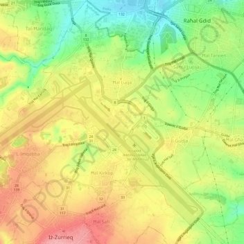
Name: Luqa topographic map, elevation, terrain.

Location: Luqa, Southern Region, Malta (35.82804 14.45763 35.87566 14.51397)

Average elevation: 223 ft

Minimum elevation: 10 ft

Maximum elevation: 417 ft

Other topographic maps

Click on a map to view its topography, its elevation and its terrain.

Blue Grotto

Malta > Southern Region > Żurrieq

Average elevation: 200 ft

Filfla

Malta > Southern Region > Żurrieq

Average elevation: 0 ft

Gear up for your next adventure:

📻Weather Alert Radios - Stay informed of storm risks while off-the-grid
🧦Merino Wool Socks - Moisture-wicking, blister-preventing socks for long treks
🏥Hiking First Aid Kits - Comprehensive medical kits for remote trail injuries
🪶Survival Guide Book - Expert advice for emergency preparedness
🦶Carbon Trekking Poles - Reduce knee impact on steep descents with ultra-light poles

As an Amazon Associate, this site earns from qualifying purchases at no extra cost to you.