
Thank you for supporting this site ❤️
Make a donation
Make a donation
Gear up for your next adventure:
As an Amazon Associate, this site earns from qualifying purchases at no extra cost to you.
Shafipur topographic map
Click on the map to display elevation.
Thank you for supporting this site ❤️
Make a donation
Make a donation
Gear up for your next adventure:
As an Amazon Associate, this site earns from qualifying purchases at no extra cost to you.
About this map
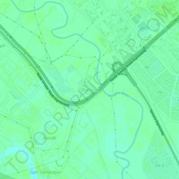
Name: Shafipur topographic map, elevation, terrain.
Location: Shafipur, Gautam Buddha Nagar, Uttar Pradesh, 201308, India (28.42752 77.46619 28.46752 77.50619)
Average elevation: 643 ft
Minimum elevation: 623 ft
Maximum elevation: 663 ft
Thank you for supporting this site ❤️
Make a donation
Make a donation
Gear up for your next adventure:
As an Amazon Associate, this site earns from qualifying purchases at no extra cost to you.