

Defreestville topographic map
Click on the map to display elevation.
About this map

Name: Defreestville topographic map, elevation, terrain.
Average elevation: 322 ft
Minimum elevation: -3 ft
Maximum elevation: 561 ft
Rensselaer County trails, hiking, mountain biking, running and outdoor activities
Other topographic maps
Click on a map to view its topography, its elevation and its terrain.

Town of Grafton
United States > New York > Rensselaer County
Grafton possesses the most uneven surface of any town in the county. It is located within the limits of the Rensselaer Plateau and the principal peaks in the town reach an altitude of 1800 feet above the level of the sea. A small portion of the land only is arable, but the hillsides afford excellent grazing.…
Average elevation: 1,289 ft


Averill Park
United States > New York > Rensselaer County > Town of Sand Lake > Averill Park
Average elevation: 807 ft


City of Troy
United States > New York > Rensselaer County
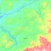
The western edge of the city is flat along the river, and then steeply slopes to higher terrain to the east. The average elevation is 50 feet, with the highest elevation being 500 feet in the eastern part of the city. The city is longer than it is wide, with the southern part wider than the northern section of…
Average elevation: 266 ft

Village of Hoosick Falls
United States > New York > Rensselaer County > Town of Hoosick
Average elevation: 545 ft


Village of East Nassau
United States > New York > Rensselaer County > Town of Nassau
Average elevation: 856 ft

Upper Lansingburg Reservoir Dam
United States > New York > Rensselaer County > City of Troy
Average elevation: 302 ft

Troy Distributor Dam
United States > New York > Rensselaer County > City of Troy
Average elevation: 246 ft

Town of East Greenbush
United States > New York > Rensselaer County
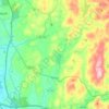
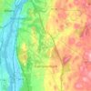
The western section of the town, along the Hudson River is marked by bluffs that rise to an elevation of between 100 and 300 feet. The little flat land that exists along the river is on the Papscanee Island. Papscanee Island is actually a peninsula, separated from the rest of the town by the Papscanee Creek.…
Average elevation: 292 ft
City of Troy
United States > New York > Rensselaer County
The western edge of the city is flat along the river, and then steeply slopes to higher terrain to the east. The average elevation is 50 feet, with the highest elevation being 500 feet in the eastern part of the city. The city is longer than it is wide, with the southern part wider than the northern section of…
Average elevation: 266 ft

Village of Hoosick Falls
United States > New York > Rensselaer County > Town of Hoosick
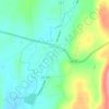
Average elevation: 545 ft
City of Troy
United States > New York > Rensselaer County
The western edge of the city is flat along the river, and then steeply slopes to higher terrain to the east. The average elevation is 50 feet, with the highest elevation being 500 feet in the eastern part of the city. The city is longer than it is wide, with the southern part wider than the northern section of…
Average elevation: 266 ft