
Champaign topographic map
Interactive map
Click on the map to display elevation.
About this map
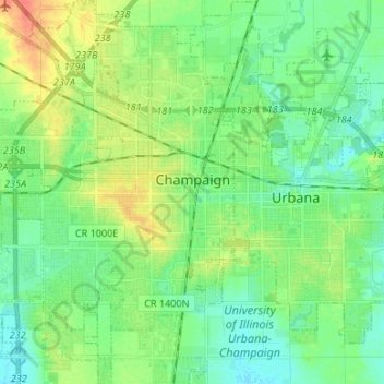
Name: Champaign topographic map, elevation, terrain.
Location: Champaign, Champaign County, Illinois, United States (40.06186 -88.33337 40.16398 -88.22122)
Average elevation: 741 ft
Minimum elevation: 696 ft
Maximum elevation: 833 ft
Champaign County trails, hiking, mountain biking, running and outdoor activities
Other topographic maps
Click on a map to view its topography, its elevation and its terrain.