
Thank you for supporting this site ❤️
Make a donation
Make a donation
Gear up for your next adventure:
As an Amazon Associate, this site earns from qualifying purchases at no extra cost to you.
Karsa topographic map
Click on the map to display elevation.
Thank you for supporting this site ❤️
Make a donation
Make a donation
Gear up for your next adventure:
As an Amazon Associate, this site earns from qualifying purchases at no extra cost to you.
About this map
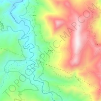
Name: Karsa topographic map, elevation, terrain.
Location: Karsa, San Mauro Castelverde, Palermo, Sicilia, 90010, Italia (37.90490 14.13532 37.94490 14.17532)
Average elevation: 1,447 ft
Minimum elevation: 377 ft
Maximum elevation: 2,822 ft
Thank you for supporting this site ❤️
Make a donation
Make a donation
Gear up for your next adventure:
As an Amazon Associate, this site earns from qualifying purchases at no extra cost to you.