Geolocate

Sicchez topographic map

Click on the map to display elevation.

About this map

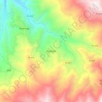
Name: Sicchez topographic map, elevation, terrain.

Location: Sicchez, Sícchez, Province of Ayabaca, Piura, Peru (-4.61013 -79.80397 -4.53013 -79.72397)

Average elevation: 5,135 ft

Minimum elevation: 2,372 ft

Maximum elevation: 8,196 ft

Gear up for your next adventure:

❄️Traction Cleats - Prevent slips on icy trails during winter hikes
🥇GPS Hiking Watch - Multi‑sport GPS watch with navigation and trail tracking
🎒Outdoor Daypacks - Lightweight backpacks designed for carrying maps and essential gear
🧭Orienteering Set - Complete compass and map reading kit
🪶Wildlife Field Guides - Learn animal tracking and species ID

As an Amazon Associate, this site earns from qualifying purchases at no extra cost to you.