
Make a donation
Gear up for your next adventure:
As an Amazon Associate, this site earns from qualifying purchases at no extra cost to you.
Campo Imperatore topographic map
Click on the map to display elevation.
Make a donation
Gear up for your next adventure:
As an Amazon Associate, this site earns from qualifying purchases at no extra cost to you.
Campo Imperatore
The plateau's altitude ranges from 1,500 to 1,900 meters. It covers an expanse of approximately 80 km2. Campo Imperatore is home to one of Italy's oldest alpine ski resorts. Located on the plateau's western edge, the resort began commercial operation in the 1920s and continues to thrive as a ski resort to this day due to its proximity to Rome (132 km). The resort's hotel became dictator Benito Mussolini's prison in August 1943 with his fall from power until he was freed by German commandos on 12 September 1943. On the eastern side of the plateau is a 4 km cross country ski trail, which is maintained by the nearby town of Castel del Monte.
Make a donation
Gear up for your next adventure:
As an Amazon Associate, this site earns from qualifying purchases at no extra cost to you.
About this map
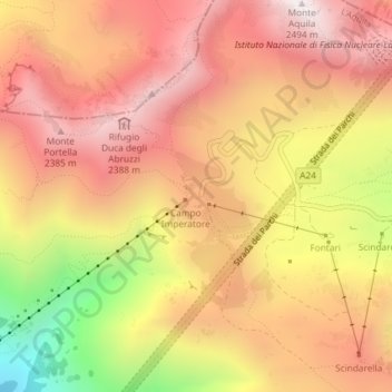
Name: Campo Imperatore topographic map, elevation, terrain.
Location: Campo Imperatore, L'Aquila, Abruzzo, 67026, Italy (42.43305 13.54872 42.45305 13.56872)
Average elevation: 6,745 ft
Minimum elevation: 4,459 ft
Maximum elevation: 8,123 ft
Make a donation
Gear up for your next adventure:
As an Amazon Associate, this site earns from qualifying purchases at no extra cost to you.