
Thank you for supporting this site ❤️
Make a donation
Make a donation
Gear up for your next adventure:
As an Amazon Associate, this site earns from qualifying purchases at no extra cost to you.
Beinen topographic map
Click on the map to display elevation.
Thank you for supporting this site ❤️
Make a donation
Make a donation
Gear up for your next adventure:
As an Amazon Associate, this site earns from qualifying purchases at no extra cost to you.
About this map
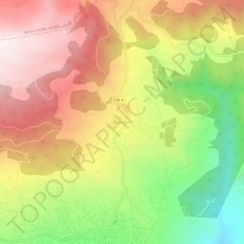
Name: Beinen topographic map, elevation, terrain.
Location: Beinen, Terrai Bainen, Daïra Terrai Bainen, Mila, Algérie (36.53116 6.10602 36.57116 6.14602)
Average elevation: 2,523 ft
Minimum elevation: 994 ft
Maximum elevation: 3,878 ft
Thank you for supporting this site ❤️
Make a donation
Make a donation
Gear up for your next adventure:
As an Amazon Associate, this site earns from qualifying purchases at no extra cost to you.