
Thank you for supporting this site ❤️
Make a donation
Make a donation
Gear up for your next adventure:
As an Amazon Associate, this site earns from qualifying purchases at no extra cost to you.
Hofstatt topographic map
Click on the map to display elevation.
Thank you for supporting this site ❤️
Make a donation
Make a donation
Gear up for your next adventure:
As an Amazon Associate, this site earns from qualifying purchases at no extra cost to you.
About this map
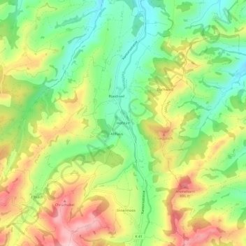
Name: Hofstatt topographic map, elevation, terrain.
Location: Hofstatt, Luthern, Luzern, 6154, Schweiz (47.06495 7.89428 47.10495 7.93428)
Average elevation: 2,507 ft
Minimum elevation: 2,142 ft
Maximum elevation: 2,972 ft
Thank you for supporting this site ❤️
Make a donation
Make a donation
Gear up for your next adventure:
As an Amazon Associate, this site earns from qualifying purchases at no extra cost to you.