Geolocate

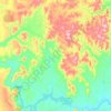
Polinésia topographic map

Click on the map to display elevation.

About this map

Name: Polinésia topographic map, elevation, terrain.

Location: Polinésia, Boa Vista do Tupim, Região Geográfica Imediata de Itaberaba, Região Geográfica Intermediária de Feira de Santana, Bahia, Região Nordeste, Brasil (-12.61951 -40.72100 -12.57951 -40.68100)

Average elevation: 1,463 ft

Minimum elevation: 1,083 ft

Maximum elevation: 1,998 ft

Other topographic maps

Click on a map to view its topography, its elevation and its terrain.
Brejo Novo

Brasil > Bahia > Boa Vista do Tupim

Average elevation: 1,535 ft

Gear up for your next adventure:

🍳Camping Cook Set - Complete cookware for outdoor meals
🧥Waterproof Jacket for Hiking - Breathable and rugged rain jacket for outdoor excursions
📌Outdoor GPS Map App - Apps and devices for digital topographic navigation
🌲Outdoor Survival Books - Best books on survival skills
💧Water Filtration Bottles - Safely drink from streams and lakes while exploring

As an Amazon Associate, this site earns from qualifying purchases at no extra cost to you.