
Comanche topographic map
Click on the map to display elevation.
About this map
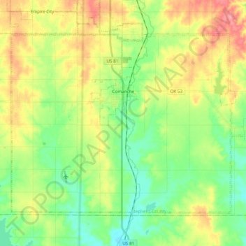
Name: Comanche topographic map, elevation, terrain.
Location: Comanche, Stephens County, Oklahoma, 73529, United States (34.29051 -98.05140 34.40612 -97.85993)
Average elevation: 1,033 ft
Minimum elevation: 919 ft
Maximum elevation: 1,198 ft
Stephens County trails, hiking, mountain biking, running and outdoor activities
Other topographic maps
Click on a map to view its topography, its elevation and its terrain.