
Thank you for supporting this site ❤️
Make a donation
Make a donation
Gear up for your next adventure:
As an Amazon Associate, this site earns from qualifying purchases at no extra cost to you.
Atenas topographic map
Click on the map to display elevation.
Thank you for supporting this site ❤️
Make a donation
Make a donation
Gear up for your next adventure:
As an Amazon Associate, this site earns from qualifying purchases at no extra cost to you.
About this map
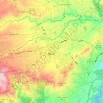
Name: Atenas topographic map, elevation, terrain.
Location: Atenas, Cantón Atenas, Provincia Alajuela, 20501, Costa Rica (9.96027 -84.39608 9.99687 -84.34101)
Average elevation: 2,238 ft
Minimum elevation: 1,234 ft
Maximum elevation: 3,186 ft
Thank you for supporting this site ❤️
Make a donation
Make a donation
Gear up for your next adventure:
As an Amazon Associate, this site earns from qualifying purchases at no extra cost to you.