
Thank you for supporting this site ❤️
Make a donation
Make a donation
Gear up for your next adventure:
As an Amazon Associate, this site earns from qualifying purchases at no extra cost to you.
Pardieiro topographic map
Click on the map to display elevation.
Thank you for supporting this site ❤️
Make a donation
Make a donation
Gear up for your next adventure:
As an Amazon Associate, this site earns from qualifying purchases at no extra cost to you.
About this map
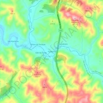
Name: Pardieiro topographic map, elevation, terrain.
Location: Pardieiro, São Barnabé, Almodôvar, Beja, Portugal (37.36600 -8.28473 37.40600 -8.24473)
Average elevation: 748 ft
Minimum elevation: 466 ft
Maximum elevation: 1,165 ft
Thank you for supporting this site ❤️
Make a donation
Make a donation
Gear up for your next adventure:
As an Amazon Associate, this site earns from qualifying purchases at no extra cost to you.