
Thank you for supporting this site ❤️
Make a donation
Make a donation
Gear up for your next adventure:
As an Amazon Associate, this site earns from qualifying purchases at no extra cost to you.
Lamaadhane topographic map
Click on the map to display elevation.
Thank you for supporting this site ❤️
Make a donation
Make a donation
Gear up for your next adventure:
As an Amazon Associate, this site earns from qualifying purchases at no extra cost to you.
About this map
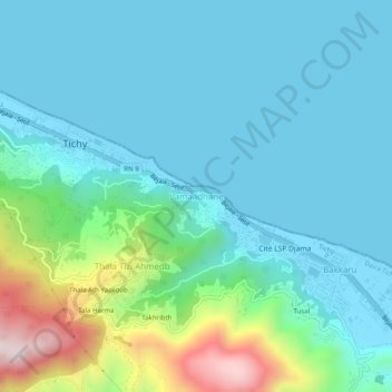
Name: Lamaadhane topographic map, elevation, terrain.
Location: Lamaadhane, Tichy, Tichy District, Bejaia, 06023, Algeria (36.64355 5.15295 36.68355 5.19295)
Average elevation: 387 ft
Minimum elevation: -7 ft
Maximum elevation: 2,024 ft
Thank you for supporting this site ❤️
Make a donation
Make a donation
Gear up for your next adventure:
As an Amazon Associate, this site earns from qualifying purchases at no extra cost to you.