
坪上镇 topographic map
Interactive map
Click on the map to display elevation.
About this map
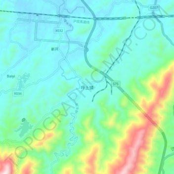
Name: 坪上镇 topographic map, elevation, terrain.
Location: 坪上镇, 新邵县, 邵阳市, 湖南省, 中国 (27.50427 111.48483 27.58427 111.56483)
Average elevation: 1,168 ft
Minimum elevation: 630 ft
Maximum elevation: 3,094 ft
Other topographic maps
Click on a map to view its topography, its elevation and its terrain.