Geolocate

Garur topographic map

Click on the map to display elevation.

About this map

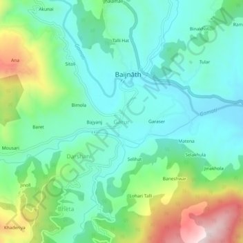
Name: Garur topographic map, elevation, terrain.

Location: Garur, Garud, Bageshwar District, Uttarakhand, 263641, India (29.88067 79.59380 29.92067 79.63380)

Average elevation: 4,035 ft

Minimum elevation: 3,589 ft

Maximum elevation: 5,187 ft

Gear up for your next adventure:

🪑Portable Camp Table - Compact table for campsite meals
⛑️Personal Locator Beacon - Safety beacon for emergencies
🗻Climbing Gear Basics - Essential gear for beginner climbers
GPS Sports Watch - GPS watch for running, hiking and training
🛡️Insect Repellent - Protection against bugs during outdoor activities

As an Amazon Associate, this site earns from qualifying purchases at no extra cost to you.